


The Long Coast South: A Ledger, Reopened

Part 2
John J. King II · July 2026
Turnagain Arm
There was a third chapter to our recent Alaska journey that I did not touch in the first essay, a side trip that bent us away from tundra and sea ice and down toward the temperate underbelly of mainland Alaska. From Anchorage we followed the Seward Highway south, trading city streets for the sinuous shoreline of Turnagain Arm and the spruce-darkened slopes of the Chugach Range, chasing birds we had missed around Anchorage and the promise of a dramatic coastline we both wanted to see again.

Turnagain Arm was in one
of its restless moods, the tide running hard against the mudflats in a long gray shove that reminded us how much energy breathes in and out of this narrow inlet each day. We slipped past the Alyeska ski resort and into deeper mountains, stopping often at pullouts just to watch cloud bands snag on ridgelines or lean out over the water with binoculars, hoping for distant specks of gulls and ducks riding the currents. Benny J.S., our guide, leader, and driver, supplied the soundtrack: a spectacular playlist of vintage 1970s oldies that stitched the drive to Pam's own history in ways we had not expected.

Pam's Bakery
For Pam it was more than a scenic detour. Over fifty years ago she and a high-school friend had made this same trip to Seward one summer to work in a local bakery, a way to earn a bit of cash and have their own small adventure. Her friend's father, a commercial salmon fisherman, had encouraged the journey, promising both hard work and the wide water world of Resurrection Bay. Seward has changed dramatically since those early 1970s days — tour boats where cannery trucks once idled, visitor centers where bunkhouses used to lean — but after some wandering we finally found the building that had housed the bakery, still standing, its current incarnation layered over the smell of bread and the chatter of teenagers Pam remembered.
Our goal in coming to Seward this time was to trade memory for salt water and seabirds. Seward sits tucked into Resurrection Bay, a steep-walled inlet ringed by mountains that still held snow on their shoulders despite the calendar's insistence that summer had begun. From the harbor we would board one of the purpose-built eco-excursion vessels that run daily into Kenai Fjords National Park, boats designed with high bow decks, low exhaust, and wide viewing rails so passengers can spend hours outside watching wildlife without constantly ducking spray or diesel fumes.
The Orca Song Casts Off
Our boat that morning — the morning of June 16, 2026 — was the M/V Orca Song, one of two small-vessel monohulls Major Marine Tours uses to run its 8.5-hour Northwestern Fjord Cruise out of Seward. Sixty-five feet on the water, single hull, sixty passengers, an eighteen-knot cruising speed, a heated cabin below and two open decks above with a covered awning on the upper. Her sister vessel on this route is the M/V Viewfinder, a slightly smaller hull; on any given day of the season either boat may be running the fjord. The two are used interchangeably. On June 16, in our case, it was the Orca Song, under Captain John, with our naturalist Carl on the intercom and Rowen working the deck.
The cloudless sky was already gleaming when the Orca Song cast off, and the mountains around Resurrection Bay stood in that hard, clean light the North Pacific reserves for the day after a blow. Two previous sailings had been scratched by the low that had just moved off — thirty-five-knot winds and an eight-foot sea will end an excursion day before it begins — and there was a quiet satisfaction on the bow rail among passengers who understood they were getting the trip that yesterday's cohort had not.

What the Ice Remembered
For me the smell of glacial melt and the sudden chill of spray blown off the ice floes did something I had not expected. It pried loose a set of memories that had been sitting dormant for half a century — the cold mineral scent of water that had been ice five minutes earlier, the particular blue weight of air off a tidewater face, the way that air arrives on your skin before your eyes have quite caught up. In a single breath I was no longer standing on the observation deck of a Kenai Fjords excursion vessel. I was standing on the working deck of the F/V Viking Rover, twenty-two years old, the greenest of greenhorns, in May of 1975.
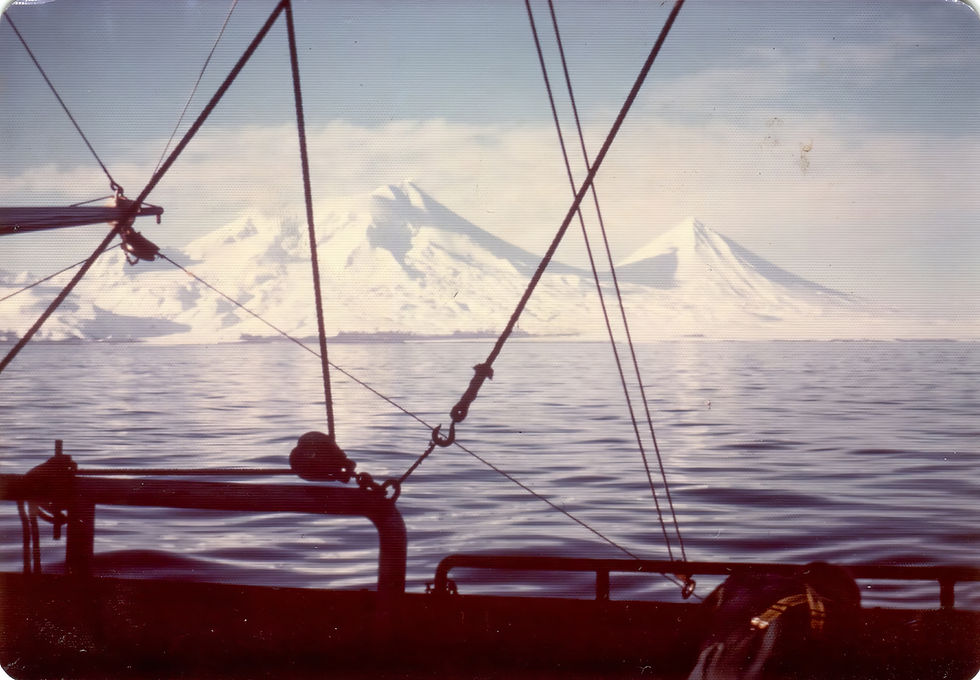
Long before I understood what I was joining, I had signed on under the command of the boat's owner and skipper, Richard "Dick" King — no relation of mine, in spite of the shared surname — for her second voyage north. We left Tacoma in the last cold light of a Puget Sound spring and threaded the Inside Passage north through the Strait of Georgia, Johnstone Strait, and Queen Charlotte Sound, past Prince Rupert and up through Clarence Strait to Ketchikan, then on to Wrangell and up Sumner Strait — a corridor of tide rips and mist-hung spruce that felt, to a new hand, less like a route than an initiation. Dick preferred, when the weather cooperated, to exit Southeast Alaska at Cape Decision on the south end of Kuiu Island rather than run the extra day north to Cape Spencer, and that was the corner we turned in 1975: a hard westerly heading out into the Gulf. From there we swung west across open water, running south of Middleton Island before angling down into Shelikof Strait, then on toward the Shumagin Islands and the crab grounds that waited beyond. Standing on the Viking Rover's deck in 1975, I was, by the geographer's arithmetic, about seventy-five miles south of the entrance to Resurrection Bay — almost certainly the closest I had ever come to Seward in my life until this day.


The industry I was joining had been built by a small number of pioneers whose names still carry weight along this coast. Lowell Wakefield had launched Wakefield Seafoods out of Port Wakefield on Kodiak Island in the late 1940s, effectively inventing the modern king-crab fishery and its cold-chain infrastructure — the freezer ships, the section-cut product, the global luxury market that would eventually pay for boats like ours. Mansel G. Blackford, working out of Ohio State, would later tell that story with unusual care in Pioneering a Modern Small Business: Wakefield Seafoods and the Alaskan Frontier (JAI Press, 1979), the sixth volume in a series on industrial development and the social fabric. Chuck Bundrant, a Tennessee farm kid who came north with almost nothing and built Trident Seafoods out of Kodiak in those same early years, is the subject of a more recent oral history, the podcast A Deckload Full of Dreams. I did not know any of that history in May of 1975. What I knew was that king crab was becoming the high-end seafood of the world, that a good season on a good boat could change a young man's life, and that Dick King had given me a berth.
In the four years that followed — 1975 to 1979 — I hardened into the trade. I learned to read weather that could kill me, to work through mechanical failures at three in the morning in a following sea, to manage a crew when I did not yet know how to manage myself, to watch markets swing on cues I could not see. By 1979 I was skippering a boat with part ownership and had come to think of the Bering Sea and the Gulf the way a modern prospector thinks of a placer claim, in units of soak time and pot lifts and price per pound. The logic was simple: the crab were out there, my share of them was finite, and every hour not fishing was an hour subtracted from a life I was trying to build against long odds.

That logic did its work. Somewhere in those years I stopped seeing the country I was moving through. The kittiwakes on the cliff faces, the whales blowing off a working deck, the way the Chugach caught last light behind us as we ran west — I had learned to note them the way a driver notes mile markers, information without meaning. I became, in the honest accounting of it, an opportunist fisherman out to get my fair share no matter the cost. It was a darker stretch of my formative years, and it is not a period I am proud of now.

The transition had not happened overnight. It came gradually, in weather and equipment failures and near-drownings that I would later gather under a single working title — The Year of Living Very Dangerously, 1976 — a chapter for another day. What I want to mark here is only the shape of it: that the young man on the Viking Rover passing south of Middleton Island in 1975 was already being pulled, without knowing it, toward a version of himself who would look at this same coast and see almost nothing but yield.

Fifty-one years later, on a windless morning in Resurrection Bay, the spray came off the ice and the smell arrived first, the way it always had, and I found myself sitting with that tension. The greenhorn could not have imagined the older man on the observation deck. The older man, watching a humpback exhale in a stand of gold light, could suddenly feel the greenhorn's cold hands on a wet rail — and could feel, too, the long arc of subtraction between them. The Gulf of Alaska, in the end, is not so large that a life cannot loop back through it. What has changed is what I am willing to see.
Two Whales in the First Half Hour
We had barely cleared the inner harbor when the ship's intercom crackled and the mate came on with the kind of announcement that changes the temperature on a boat: a humpback whale had been sighted about a thousand yards ahead, lunge-feeding at the surface, a behavior not often seen this close to the head of the bay.

The whale — a single adult working alone — was doing the whole choreography for us. She would arch into a shallow surface dive and disappear for perhaps thirty seconds, corralling a tight bait ball of Pacific herring beneath her with a slow-turning curtain of bubbles and the sweep of her enormous pectoral fins, then erupt through the surface with her jaw already unhinged, scooping in tons of saltwater and the herring inside it. She would right herself, close, and exhale a bright spout of vaporized seawater into the still air before beginning the process again. Humpback lunge-feeding is one of the great acts of ocean mechanics, a body the size of a school bus timed against fish the size of a thumb, and to see it inside a fjord's protected water rather than out on the open coast is a small piece of luck.
I managed to catch one of the lunges on a short iPhone video — imperfect, hand-shaken, the sound of my own breath in the microphone, but the geometry of the strike is all there. A young woman standing near the rail asked, politely, if she could have a copy. She was in her mid-twenties, traveling with her young husband; both had been born in India and were now living in Texas, and this was the first whale either of them had ever seen. She typed an email address into my phone with the careful attention of someone who has understood that this is not an ordinary morning. It would be weeks before I sent it, back home in Seattle, sitting at a desk far from any water. But I would send her a proper file — not a compressed social-media stub but the full clip, the kind of thing you can keep — so that her first whale would live in her archive at something like its true weight.

The humpback turned out to be a good omen. About three miles beyond her, once the Orca Song had cleared the last of Resurrection Bay's protected water and put its bow into the broader swell of the outer coast, we came upon a second cetacean sighting, rarer and briefer and of an altogether different scale. Two mature fin whales — the second-largest animal ever to have lived, after the blue — were traveling west-southwest at surface speed, headed in the general direction of Kodiak.

Two great whales in the first thirty minutes, on a boat that had not been able to leave the dock for two days, is a piece of luck that a fisherman learns not to talk too much about. I stood at the rail as the Orca Song resumed her course and thought about the young couple from Texas, and the herring beneath us, and the fin whales driving toward Kodiak on some errand of their own, and about how much of this water I had once crossed without looking.

The Alcids
The sun was up and the wind was down, but the air at the rail told a different story. Air off snowfields and tidewater ice does not care what the calendar says; it moves cold and heavy across the deck, and most of the Orca Song's passengers had retreated inside to the heated cabin, where the windows were good and the coffee was hot. The rail belonged, for the moment, to the small tribe of us willing to trade comfort for line of sight — hoods up, gloves on, cameras out — and to Carl on the intercom, who had learned the useful trick of announcing every serious sighting twice, giving the cabin passengers time to zip up and come out before the animal was gone.

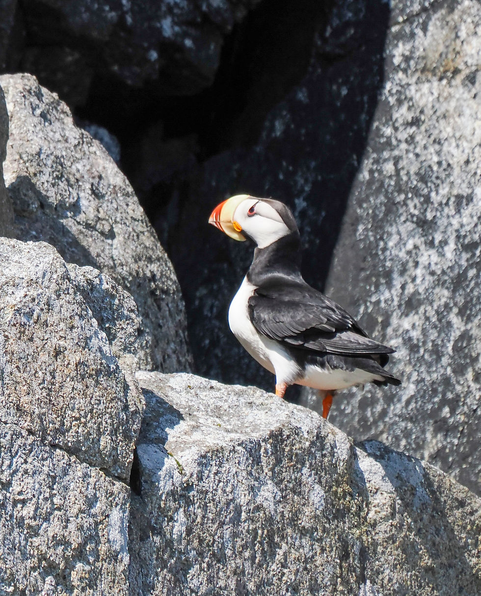
The alcids began almost at once. They came in small fast flocks, six or eight or a dozen birds together, flying low and hard just above the surface with the stiff whirring wingbeat that marks the family — birds built for swimming first and flying second, their small wings driving them through water more efficiently than through air. Horned puffins passed us in pairs, their pale faces and dark backs unmistakable in binoculars; tufted puffins followed, blacker, heavier, with the trailing golden plumes that give them their name and, in breeding light, an almost ceremonial look. The light was high and hard and made photography a running argument with contrast — bright water below, dark birds above, no forgiveness in the middle — and I burned through a lot of frames for the two or three that would be worth keeping.

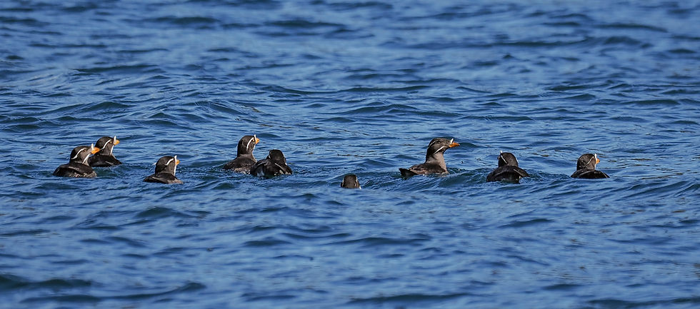
Farther along the outer coast we came upon the rafts. Puffins gather on the water in loose social groups between foraging trips, and we found several rafts of two to three dozen birds sitting shoulder to shoulder in the swell, half asleep, half watching the boat. Captain John did the thing that separates a good excursion skipper from a merely competent one: he cut speed early, let the engines drop to a murmur, and ghosted us in on the last of our own wake, so that the birds had every chance to decide for themselves. It was still a crapshoot. Some rafts held their line and let us drift within thirty yards; others detonated into flight at what looked like the same distance, the whole group airborne in a single ragged instant, wings clattering the water as they went. There is no reading it in advance. You take what the birds give you.
Not every bird at the rail that morning was an alcid. A Pacific Loon crossed our bow at close range, low and fast over the swell, wings held in the drooping loon posture, feet trailing straight back past the tail. The bold white checkerboard on its scapulars — two neat rows of bright rectangles against a dark back, a pattern no other North American loon carries in breeding plumage — was as clear a field mark as any bird gives you in flight, and it settled the identification before the bird was past the pilothouse. A different animal from the puffins on the water: longer-winged, faster, built for distance rather than for pursuit-diving, but working the same North Pacific.


The Chiswell Islands
The cliffs gave more. As we angled toward the Chiswell Islands — a scatter of pinnacles and stacks rising abruptly out of the outer bay, named in 1786 by the British navigator Nathaniel Portlock for a wealthy patron and known to the Russians before that as the Ostrova Ayaliki — Carl eased us close enough for us to see what the rock was actually doing. These are not ordinary sea stacks. They are plutons: fingers of igneous rock, granite and granodiorite, that pushed up as molten magma into the softer sedimentary country rock of the Chugach terrane fifty to sixty million years ago, cooled slowly at depth into hard crystalline stone, and were then exhumed as glacier and storm scoured the softer material away. What remains, standing hard against the Gulf, is the durable skeleton of a much larger landscape — the same erosion-resistant granodiorite that surfaces again at the mouth of Northwestern Fjord and along the Aialik Peninsula, part of the exotic terranes that assembled Alaska over the last hundred million years and continue to assemble it today.


The birds have found the granite. Softer greywacke islands like Nuka, easily eroded, hold almost no seabird colonies; the Chiswell plutons, by contrast, are among the most important seabird colonies in the Gulf of Alaska, home to tens of thousands of murres, kittiwakes, puffins, and auklets. Every horizontal crack, every shallow ledge, every gap between fitted stones was a nesting place. Common murres in their black-and-white uniforms stood shoulder to shoulder on the widest ledges; black-legged kittiwakes had cemented cup nests into the smallest depressions, so many of them that the cliff face read as a slow-moving mosaic of white bodies and gray backs. Higher up, in the shadowed vertical slots where the rock ran deepest, tufted puffins had gone into burrows or crevices we could not see into, so that we knew of their presence only from the birds arriving and departing with fish in their bills. The whole stack was a vertical city, layered by species, and if you stood still and let your eyes adjust to the density of it, you could feel the sheer accounting of what a productive North Pacific summer, given the right rock, still delivers.




What Alaska Is Actually Made Of
To stand on the deck of the Orca Song and look east across the Chiswells toward the Chugach front is to look at a landscape that is not, in the deepest sense, from here. Less than one percent of Alaska's present surface area is bedrock that has been part of North America from the beginning. The rest — the mountains, the fjord walls, the seabird spires, the granodiorite plutons standing hard against the Gulf — arrived from somewhere else, one crustal parcel at a time, over roughly the last two hundred million years. The technical term for such an arriving parcel is a terrane: a fault-bounded package of rock whose geologic history, fossil fauna, and paleomagnetic signature are demonstrably different from the country it now sits inside. The parcels that most obviously did not originate on the North American margin are called exotic terranes, and Alaska is the world's most spectacular collage of them.
The geologist Nick Zentner, working out of Central Washington University in Ellensburg, has spent much of the last decade making this framework legible to non-specialists in a long series of public lectures on the assembly of Alaska and the Pacific Northwest. The framework itself belongs to a lineage of Cordilleran geologists — Peter Coney, Jim Monger, David Jones, George Plafker, and others — who in the 1970s recognized that the tectonic collage extending from Baja California through British Columbia to the Aleutians could not be explained by simple continental drift. It required a smaller-scale process: exotic-terrane accretion. Fragments of ocean floor, volcanic island arcs, and even slivers of continental crust rode north on the conveyor belt of the Pacific and Farallon plates, sometimes for thousands of miles, and were welded onto the western edge of the continent as those plates dove beneath it. In this sense, exotic terranes are a miniature version of continental drift — not whole continents in motion, but continent-scale margins built up piece by piece from imported rock.
The rocks under Kenai Fjords tell the story compactly. The great Wrangellia composite terrane — Alexander, Wrangellia, and Peninsular fragments now scattered from Vancouver Island through Haida Gwaii to south-central Alaska — docked in the middle Cretaceous, roughly a hundred million years ago, and forms much of the inboard skeleton. Outboard of Wrangellia, and beneath our hull, lies the Chugach–Prince William terrane, one of the thickest accretionary complexes on Earth, exposed for some twenty-two hundred kilometers along the southern Alaskan coast. Its inboard half, the Chugach, is Late Cretaceous marine flysch that arrived about sixty-seven million years ago; its outboard half, the Prince William, is Paleocene-to-Eocene deep-sea fan sediments that joined roughly fifty million years ago. The granodiorite plutons of the Chiswells intruded these sediments as they were still accreting, cooled slowly at depth, and were exhumed by glaciers over the last several million years. Even now the process has not stopped. The Yakutat microplate, just to the east, is the latest terrane to arrive, and is currently in the act of colliding — the reason the St. Elias Mountains are the fastest-rising range in North America and the reason the 1964 Good Friday earthquake shook these fjords hard enough to drop the coastline three to six vertical feet in a single afternoon.


The point, in the longer ecological ledger, is not the vocabulary. It is the timescale. The sea otter in the swell, the puffins on the pluton, the harbor seal pup on her floating fortress, and the two of us on the rail are all riding the surface of a landscape that has been assembling itself since long before any of our species existed, and is still assembling itself now. Alaska is not a place. It is a process in progress.

Northwestern Fjord and the Ice Nursery
Turning the corner into Northwestern Fjord was a change of temperature and a change of mind. Northwestern Glacier is a tidewater glacier — a river of ice whose terminus reaches all the way to the sea, calving directly into salt water rather than melting on land — and its face at the head of the fjord throws a cold breath down the length of the arm that arrives on the boat long before the ice itself does. The water ahead of us thickened with brash and small growlers, then with bergy bits the size of pickup trucks, all of it pale blue and slowly turning in the current. The mountains stepped in close on either side. The engine note dropped again.
The harbor seals were on the ice. Newborn pups, some of them only a few days old, lay on almost every third floe, their mothers hauled out beside them or watching from the water nearby. Tidewater-glacier ice is one of the most important pupping habitats left to Phoca vitulina richardii in the Gulf of Alaska, and the reason is not aesthetic. It is defensive. A seal pup on solid land is available to bears and wolves; a pup on drifting ice, in water too cold and too broken for most terrestrial predators to cross, is available principally to killer whales, and even the killer whales must work for it. The mothers had chosen this nursery for the same reason their mothers had, and their mothers before them: the ice is a moving fortress, renewed daily by the glacier at the head of the fjord, and it costs a predator dearly to hunt across it.
We drifted through the nursery on idle, keeping our distance, and the pups paid us the small compliment of ignoring us. A few lifted their heads. Most did not. Whatever the Orca Song was in their world, it was not the shape that mattered.


The Sea Otter
The sea otters were where we had left them on the way in, floating in the swell just outside the mouth of Aialik Bay: two mothers, each with a pup lying belly-down across her chest, working at the pups' fur with the concentrated competence that makes the species look, from a distance, like small furred craftsmen at a bench. The mothers watched us pass without alarm; the pups did not watch us at all. They were, by every visible measure, exactly where sea otters ought to be — and it is worth pausing on how narrowly they came to not being there at all.

Long before these animals were born, long before the Orca Song ran this route or the National Park existed to protect it, the Danish-born navigator Vitus Bering, sailing under the flag of the Russian Empire, brought the St. Peter and the St. Paul into these waters on the Second Kamchatka Expedition of 1741. Aboard the St. Peter as ship's naturalist was Georg Wilhelm Steller, a young German-trained physician and biologist who would, in a matter of weeks and under conditions that killed most of his shipmates, become the first Western scientist to describe the sea otter, the northern fur seal, the Steller sea lion, the spectacled cormorant, the Steller's jay, the Steller's eider, and the vast and now-extinct Steller's sea cow of the Commander Islands.
Steller was often at odds with Bering and with the ship's officers; he was a difficult man and an unerring observer, and the natural history of the North Pacific begins, in the Western scientific record, with what he wrote down in a hurry between 1741 and 1742.Bering himself did not survive the voyage. Scurvy took most of the St. Peter's crew during a forced overwintering on an uninhabited island in the Commander chain that now carries the captain's name — Bering Island, at the far western end of the Aleutian arc, in what is now Russian territory. Bering died there in December 1741. Steller survived, kept the surviving crew alive on sea otter and sea cow meat through the winter, catalogued the fauna around them, and made it back to Kamchatka the following summer in a boat the survivors built from the wreckage of the St. Peter.


Nikolskoye
Nearly two decades ago, in June and July of 2008, Pam and I made our way to Bering Island. We were passengers on the Clipper Odyssey, a hundred-berth expedition vessel operated for the season by Zegrahm Expeditions — the Seattle-based outfitter that charters ships of this class and staffs them with experienced expedition leaders — on a voyage that departed Otaru, Japan, and traced a long northern arc up through Tuleny Island and the Kurils, called at Petropavlovsk-Kamchatsky on the Kamchatka Peninsula, then worked north along the Chukotkan coast and eventually through the Bering Strait and the Chukchi Sea to Nome. Bering Island — Ostrov Beringa in Russian, the largest of the Komandorski chain at the far western end of the Aleutian arc — was one of the voyage's most affecting stops.

We visited the grave. It is a modest marker on a windswept slope not far from town. The village keeps a small cultural center, and it was there that Pam and I first saw, at close range, a chagudax̂ — the bentwood hunting visor of the Unangan (Aleut) sea-kayak hunter, a thin steamed plank of driftwood bent into a curving open-crown shape and painted with spirals and rosettes whose meaning belongs to a spiritual vocabulary older than any museum label. The visor shielded the hunter's eyes from glare, funneled distant sound toward his ears, concealed his face from the sea mammals he pursued, and, in the belief of the men who wore them, honored those mammals by presenting the hunter in his finest before the animal gave itself to him. It is one of the most difficult objects in the North Pacific ethnographic record to make, and it is nearly impossible to make well.

The tradition had come close to being lost. It was rescued in the 1980s by Andrew Gronholdt, an Unangan master carver who lived in Sand Point on Popof Island in the Shumagins and, beginning around 1985, spent the last decade of his life reconstructing the bentwood method from surviving hats, historical accounts, and his own extraordinary patience with steam and wood. Gronholdt died in 1998. His students, and their students, now carry the work forward across the Aleutian chain and along the wider Pacific Northwest coast. In the years after our Nikolskoye visit I commissioned a chagudax̂ of my own from Scott Jensen, a self-taught master carver working out of Bellingham, Washington, whose studio Speaking Cedar has produced some of the finest contemporary Unangax̂ bentwood hats outside the Aleutians. Jensen's hat sits in our home in Seattle.

It is one of the small ironies of a working life on that coast that the object I now most treasure from our Bering Sea years was not made until after we had gone, by hands I did not meet until decades later, in a workshop three hours north of the Seattle house where the hat now lives.


The land around Nikolskoye did what Bering Island does to a first-time visitor. On a walk out from the village Pam and I picked up a Snowy Owl at about a mile's distance — a white shape against the tundra that lifted and drifted another five hundred meters each time we tried to close the range, and eventually decided, reasonably enough, that a mile was close enough. Along the wrack line at the shore we picked up a Rock Sandpiper feeding among the stones; on the cliffs offshore, a Red-faced Cormorant, the bird we would not manage to catch on the 2026 cruise but which the Komandorskis had already given us eighteen years earlier. Three life birds from a single Bering Island landing, in the same afternoon.
We also sat, through a translator, with Aleut villagers at Nikolskoye and heard from them about relatives on the American side of the chain whom they had not been permitted to see or hold for the working lifetime of the Cold War border. Some had never met their cousins. Others had last held them as children. The line drawn between the St. Peter and the St. Paul in 1741 had never really been unmade. It had only been redrawn under new flags.
What Bering Started

What Bering's men carried home to Kamchatka in 1742 was not a discovery so much as an inventory, and Steller's pen made the inventory legible. Among the pelts they brought back were those of Enhydra lutris, the sea otter — the densest fur in the animal kingdom, roughly a million hairs per square inch, an animal whose survival in the cold North Pacific depends on that pelt because otters, unlike whales and seals, carry no insulating layer of blubber. The Russian promyshlenniki, the fur hunters who followed Bering's route east across the Aleutians over the next century, understood the pelt as currency, and they understood the Aleut and Alutiiq peoples who could take otters from the water as the labor force that would produce it. What followed was not a trade in any honest sense of the word. Villages were entered and held; women and children were kept as hostages against the return of hunters sent out under Russian command; kayak fleets were driven eastward along the chain and eventually down the coast as far as California, extracting otters in numbers that the historical record can only estimate. By the time the practice ran its full course under the Russian-American Company and its successors, the sea otter had been hunted out of most of its range. The 1911 North Pacific Fur Seal Convention, which finally closed international otter hunting, found perhaps one to two thousand animals remaining across a range that had once held several hundred thousand. Steller's sea cow, the largest of the animals he had described on Bering Island, had already been gone since 1768 — hunted to extinction, from first Western description to last living individual, in twenty-seven years.
The animal in the swell outside Aialik Bay is the descendant of a small number of survivors. Sea otters have returned to the Kenai Fjords coast within the last several decades, part of a slow twentieth-century recovery that began with the 1911 convention, gathered strength under the Marine Mammal Protection Act of 1972, and was helped along in the Gulf of Alaska by translocations from remnant Aleutian populations. The recovery is uneven. Otters remain absent or thin across large parts of their former range; the 1989 Exxon Valdez spill killed several thousand in Prince William Sound alone, and lingering subsurface oil in the sheltered beaches of that Sound continues to be measured against otter mortality thirty-seven years later. But here, on this water, on this July morning, a mature male was doing what Steller had first watched otters do on Bering Island in the winter of 1741, and the fact of him was not nothing.
Baseline: Shumagins, 1913
Long before I stood on the deck of the Orca Song watching otters recover their old range, and long before Bering's men went ashore on Nagai for water in 1741, the working baseline of the Shumagin Islands was drawn — for the Western record, at least — by another hand. In August of 1913, twelve years after Yellowstone had begun rebuilding the American conception of what a landscape was for, and forty-two years after Henry Wood Elliott's first Pribilof watercolors had helped force the fur-seal question into international law, Elliott himself stood on the deck of a Revenue Cutter off the south side of the Shumagins and painted what he saw. The plate is dated August 2, 1913, and titled Korovin Head. Basalt cliffs rise out of a slate-blue swell; a small revenue cutter lies inshore; seabirds work the updrafts along the headland; a raft of otters and seals lies on kelp in the foreground. The animals are not decorative. They are the ledger.

What Elliott laid down in that plate is the closest thing the Shumagins have to a scientific starting line — an August-day census of what still lived along one particular headland two years after the convention closed the pelagic hunt. Everything that has happened at Korovin Head since 1913 is measurable against it. The painting is the ledger's opening entry.
The human ledger runs deeper. In 1833 the Russian-American Company established a settlement at Delarov on Unga Island — the largest of the Shumagins — as a supply station between Kodiak and the Aleutian chain, staffed by Russian promyshlenniki and by Aleut and Creole families relocated from farther west along the arc. The 1880 U.S. census recorded 185 people at Unga: 101 Aleut, 69 Creole, 15 White. Four years later a prospector named George C. King struck the Apollo lode above the village, and by the mid-1890s the Apollo Consolidated Mining Company was working the richest gold vein in the Alaska Peninsula, drawing in a second migration of miners, mostly Scandinavian, some Cornish, a scatter from everywhere else. The mine closed in 1908. Unga's slow bleed began the day the last shift walked out.
While the Apollo was still producing, a third wave arrived by sea. From the 1880s into the 1920s, cod schooners out of San Francisco worked the Shumagin banks and cured salt cod on the shore at Sanak, forty miles southwest. The schooners were owned by American companies and crewed largely by young Scandinavian men who had rounded the Horn as deckhands and were looking, in the honest accounting, for any exit from the fo'c'sle they could find. Some of them found it in the Shumagins. They deserted the schooners on Sanak, married into Aleut families, and eventually — as the salt-cod fishery declined and Sand Point on Popof Island began to take shape as a year-round settlement in the last years of the nineteenth century — moved north across the water and stayed. Their surnames are still legible in the Sand Point cemetery a hundred and thirty years later. Halverson. Gronholdt. Gunderson. Ludvick. Osterback. Anderson. Carlson. St. Nicholas Chapel was raised on the Sand Point hill in 1933, Russian Orthodox on the outside, Aleut-Scandinavian on the inside — a working ecumenism that the town has kept ever since.
Across the century after the Apollo Mine closed in 1908, the Aleut and Creole families of Unga did not so much leave as gradually walk across the water. Some crossed in the twenties. Some crossed in the fifties. Some did not close the last door on Unga Village until 1969 — six years before I first walked into Bobby Galovin's plant.

What Sand Point inherited was a working culture that was not quite Aleut, not quite Scandinavian, not quite Russian, not quite American, and different — the 1980s federal community profile is unusually blunt on this point — from every other community in the region. The Sand Pointers worked harder, learned faster, and held onto what they earned in a way their neighbors along the chain did not. In the years I would come to know them, they turned that difference into money.
I arrived in the middle of it, though I did not know that at the time. In June of 1973 I was twenty years old, broke, two weeks out of Philadelphia by car with the last three days of it on the ALCAN, and living in a tent at a small campground north of Anchorage in what was not yet quite the town of Eagle River.

A dozen or so of us were camped there — young men, most of them, working the same problem from different angles — and each evening a small gathering formed around one fire or another to compare notes. My days were spent in a phone booth on Fourth Avenue in Anchorage, working my way down a list of Alaska seafood plants, most of which were not hiring. One evening a couple returned to the campground from a ferry trip they had taken down the Kenai Peninsula to Homer, across to Kodiak on the M/V Tustumena, and back. Kodiak, they reported, was full. But they had heard, in a bar there, that a place called Sandy Point might be hiring.
The next morning I was back in the phone booth. The operator told me there was no Sandy Point in Alaska. I pressed. She corrected the vowel: not Sandy Point, but Sand Point, one active processing plant, one number to try. I dialed it. Bobby Galovin — the Plant Superintendent, a name that meant nothing to me that morning — happened to walk past the ringing phone in the office and picked it up himself. He hired me on the spot, sight unseen, over the wire. A flight from Anchorage-to-Sand Point via Cold Bay was booked for the next available bush run. I packed the tent.

Robert "Bobby" Galovin ran the plant. Johnny Emoto ran the day shift, an unflappable foreman who could carry the entire line in his head. Ray Faulk ran the night shift — Mormon, seven children living with his wife in a trailer at the edge of the yard, a quiet man whose crews trusted him. Ron Holowosko drifted from special project to special project, a stray cat on leave from the Upper Peninsula of Michigan, competent at almost anything the plant asked of him. Andrew "Brick" Foster was the Harbormaster, and the harbor Brick ran that summer was a working accident — a small basin with limited float space, the entire fleet crowded into it, a new breakwater and float system just going up on the east side of the peninsula as the U.S. Army Corps of Engineers awarded the construction contract in June and began work in August. Inge Martinson, a second-generation Norwegian from Seattle, ran the General Store; if you needed anything in Sand Point that summer that was not a fish, you saw Inge first.
Most of the Aleut families I met that summer had roots in Unga. Their parents or grandparents had walked across the water, and the town I had landed in was in the middle of becoming something new — a working, mixed, adaptive place that would within a decade be the wealthiest incorporated town in Alaska. I did not know the future. I was carrying trays of king crab sections to a freezer at three in the morning and learning what a Wakefield line felt like from the bottom rung. I worked three months, flew back east, finished college, and came north again in June of 1974 with the intention of catching on with a crab boat rather than a plant. I did — a job offer for the Viking Rover was in my hand by late October, with instructions to report to Tacoma in mid-April 1975. That is where the sea story that begins with the smell of glacial melt off the Orca Song's rail actually starts.

But the town I left in 1974 was already turning into the town the ledger would later mark.

The Alaska Department of Labor's Alaska Economic Trends for November 1986 recorded that in 1985, Sand Point posted the highest per capita income of any incorporated place in Alaska — $21,162, in a state where oil-boom wages were setting national records. It was a brief window. The king crab fishery collapsed in 1983; the herring seasons that had briefly propped up the boats in the late seventies were thin by the mid-eighties; the wealth compressed and then dispersed. But the Sand Point fleet did not go the way its neighbors did. When the crab failed, the boats turned to salmon, then to Pacific cod, then to pollock, and later back to cod again — an exceptionally diversified working portfolio, in NOAA's own words. Of the 111 salmon limited-entry permits held by Sand Point resident boat owners in 1980, 92 were still in Sand Pointers' hands as of 2008 — a retention rate no other community along the Alaska Peninsula came close to matching. Nelson Lagoon went from 51 permits to 27. False Pass went from 21 to 6. Sand Point held. The working culture Elliott could not have seen from the deck of the Revenue Cutter in 1913 — the one that would grow up in the ruins of Delarov and the Apollo and the salt-cod camps of Sanak — turned out to be one of the more durable social experiments on the North Pacific coast.

A small ledger note, easy to miss: Robert E. Galovin, the man who picked up the ringing phone in the plant office in June of 1973 and gave a broke college kid a job, later gave his name — after his death — to the new harbor he had watched rise that same summer. The Sand Point Small Boat Harbor is officially the Robert E. Galovin Small Boat Harbor. The floats we watched being driven into the mud that August are the floats his name now covers.
Sand Point, and the Life We Still Share
Pam's own path west had run through Seward first, and then, in the late summer and fall of 1974, through Sand Point. We crossed there. We did not, at the time, know what to do with the crossing. We were both twenty-two, both working the same coast at the same latitude for reasons that had almost nothing to do with one another, and it would be nearly four years — — before we got together as a couple.
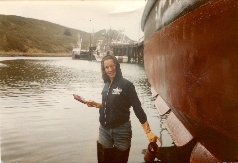
What Sand Point gave us in 1974 was a first shared coordinate: the plant, the harbor Brick Foster ran, the freezers that had carried the pelts of otters a century and a half earlier off these same islands, and the town the Delarov settlers and the Apollo miners and the schooner deserters and the Unga migrants had, without meaning to, built us to walk into. It would be years before we actually became each other's people. But the ground we would eventually build a life on had already been named. It was called Sand Point, and it sat in the Shumagins in the Russian-American fur trade's long shadow, on the working culture the century before us had assembled piece by piece.
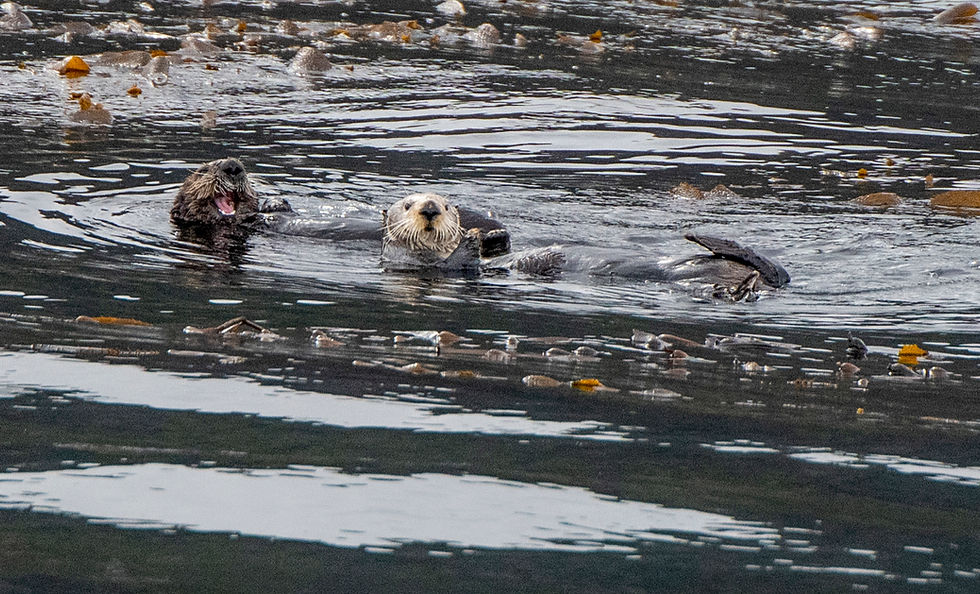
I find myself sitting with that tension. The otters in Aialik Bay and the plant at Sand Point and Bering's grave at Nikolskoye and the chagudax̂ on our wall in Seattle and the Aleut families separated by a Cold War border and Elliott's watercolor at Korovin Head are all, in the longer ecological ledger, entries in the same account. It is not a clean account. There is no place to stand outside of it. What has changed, if anything has changed, is that some of what was hunted to near-nothing has been permitted to come back, that the people who now come to these waters come with binoculars and cameras and questions rather than with hostage-taking parties and skin boats loaded with pelts, and that at least one small working town along the arc has managed, against long odds, to hold onto the wealth and the working knowledge its people built for themselves. The otters watched us pass. We watched them. The Orca Song held her line, and Aialik Bay closed behind us in the afternoon light.

Back to Seward
The return leg ran long. We had come out on the last of the low pressure's gift and would go back in against the first of the next weather system's arrival — a light southerly beginning to build under high thin cirrus, the mountains around Resurrection Bay softening at their edges as the day let go. The Orca Song held her line up the middle of the bay. Passengers came out of the cabin as the light warmed. Somewhere behind us the humpback of the morning was, presumably, still lunging through the same herring; the fin whales were somewhere off Kodiak; the harbor seal pups were still on their moving ice; the otters were still on their backs in the swell, working at their mussels, unaware of the ledger they had been asked to carry.
The Chugach caught the last of the light on our port side as we came into the harbor. Benny J.S. jumped ahead on the dock to get the van. Pam and I stayed at the rail until the Orca Song was tied off, and then we walked back up into the town where, fifty-something years ago, Pam had worked in a bakery and neither of us had yet imagined the coast we would come to know together.

The last day, in Anchorage, we walked out to Lake Hood — the world's busiest seaplane base, tucked at the edge of a residential neighborhood — to stretch our legs before the flight home. In the shallow water at the lake's south end, ten yards from the runway of a De Havilland Beaver, a single Red-throated Loon was working the surface in full breeding plumage: silver-grey head, upturned dark bill, solid rust throat patch running from the chin to the collar. A different loon from the Pacific bird of the day before, and closer than any wild loon has any right to be. The ledger does not always show its debts. Sometimes it shows what has been permitted to stay.

The next chapter — Prince William Sound, the reef, the tanker, the long half-life of the oil in those beaches — will have to wait. So will the year I have come to call The Year of Living Very Dangerously. What I can say now is only what the day itself said: that this coast is older than any of us, that some of what was taken from it has been permitted to return, and that a life spent moving across it can, if we let it, loop back through its own better questions.
The Gulf of Alaska is not so large that a life cannot loop back through it. What has changed is what I am willing to see.
— John J. King II ·
Seattle, July 2026


du doan mb hôm bữa mình lướt thấy mọi người nhắc nên ghé thử cho biết, kiểu vào xem giao diện thôi chứ không có chốt số gì. Ấn tượng đầu là họ để bài theo ngày khá rõ, cái tiêu đề “Soi cầu MB ngày 16 8 2026” nổi bật nên khỏi phải đoán đang nói ngày nào. Mình kéo xuống đọc lướt cũng dễ vì nội dung chia thành mấy đoạn ngắn, không bị dính thành một mảng chữ dài nhìn mệt. Phần “Dự Đoán XSMB 16 8 2026” cũng tách riêng thành block nên mắt bắt nhanh, muốn xem tới đâu thì cuộn tới đó. Nói chung bố cục gọn gàng, nhìn phát là nhận ra ngay…
Mình chơi xổ số kiểu cho vui là chính, coi kết quả như một thói quen giải trí chứ không đặt nặng chuyện đổi đời. Trước đây nghe người ta bàn về “cầu” với đủ kiểu mẹo, mình cũng tò mò thử tìm hiểu nhưng lúc đầu thấy mơ hồ lắm. Theo dõi một thời gian thì đúng là đôi khi có vài dạng số lặp lại làm mình chú ý hơn, nhưng mình vẫn nhắc bản thân cứ thoải mái thôi. https://soicauxsmb.io/soi-cau-3-cang-mien-phi.html Thường mình đọc nhận định rồi ghi lại vài ý ngắn, sau đó đối chiếu kết quả để xem có phải mình đang tự gán ý nghĩa không. Có hôm trúng chút thì vui, có hôm lệch…